| Lake Ngatu | |
|---|---|
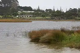 Lake Ngatu | |
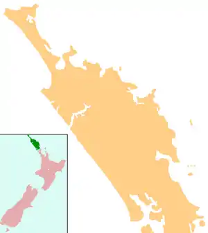  Lake Ngatu | |
| Location | Northland Region, North Island |
| Coordinates | 35°01′55″S 173°11′53″E / 35.032°S 173.198°E |
| Type | Class 1 Perched dune lake |
| Catchment area | 177.9 hectares (440 acres) |
| Basin countries | New Zealand |
| Surface area | 55.54 hectares (137.2 acres) |
| Average depth | 2.67 metres (8 ft 9 in) |
| Max. depth | 6.26 metres (20.5 ft) |
| Water volume | 1,548,165.50 cubic metres (54,672,949 cu ft) |
| Residence time | 1.565 years |
Lake Ngatu is a dune lake in the Northland Region of New Zealand.[1][2] It is located to the northwest of Awanui, near Waipapakauri.
Lake Ngatu has no inlets or outlets. The lake catchment is primarily manuka/kanuka scrub and fenced pasture.[3] There are houses overlooking the lake.
Recreation
Lake Ngatu is a popular recreation area, and is easily accessed via West Coast Road and Sweetwater Road. There is a 4-kilometre (2.5 mi) loop walking track around the perimeter of the lake.[4]
Water quality and ecology
The water quality of Lake Ngatu has been highlighted in recent times, with particular concerns of a summer algal bloom threat.[5]
The lake is monitored by Northland Regional Council, and the environmental information can be viewed on the LAWA website.[6]
See also
References
- ↑ "Place name detail: Lake Ngatu". New Zealand Gazetteer. New Zealand Geographic Board. Retrieved 23 July 2009.
- ↑ "Lake Ngatu Management Plan" (PDF). Northland Regional Council.
- ↑ "Northland Lakes Ecological Status 2010". Northland Regional Council.
- ↑ "Lake Ngatu Track". www.doc.govt.nz. Retrieved 15 September 2018.
- ↑ "Ngatu facing algal bloom threat". NZ Herald. ISSN 1170-0777. Retrieved 25 December 2018.
- ↑ "Lake Ngatu Water Quality". Land, Air, Water Aotearoa (LAWA). Retrieved 26 December 2018.
External links
- https://www.doc.govt.nz/parks-and-recreation/places-to-go/northland/places/lake-ngatu-recreation-reserve/tracks/lake-ngatu-track/
- Lake Ngatu - Water Quality and Ecological Indicators LAWA
- https://www.nrc.govt.nz/media/9534/lakengatumanagementplanwebsite.pdf
- https://www.stuff.co.nz/life-style/life/76408477/no-wharf-no-problem-kaitaia-kids-do-ladder-bombs
This article is issued from Wikipedia. The text is licensed under Creative Commons - Attribution - Sharealike. Additional terms may apply for the media files.