| Płoska | |
|---|---|
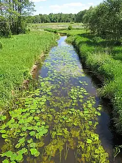 Płoska near village Zajma | |
| Location | |
| Country | Poland |
| Physical characteristics | |
| Source | |
| • location | near village Tatarowce |
| Mouth | |
• location | Supraśl near Krzemienne |
• coordinates | 53°11′38″N 23°24′28″E / 53.1939°N 23.4079°E |
| Length | 23.6 km (14.7 mi) |
| Basin size | 216 km2 (83 sq mi) |
| Discharge | |
| • average | 0.92 m3/s (32 cu ft/s) |
| Basin features | |
| Progression | Supraśl→ Narew→ Vistula→ Baltic Sea |
Płoska - is a river in east Poland in Podlaskie Voivodeship, a left tributary of the Supraśl River, with a length of 23,6 kilometres and the basin area of 216 km2. There is good river for rafting. The largest tributary is Świniobródka.
This article is issued from Wikipedia. The text is licensed under Creative Commons - Attribution - Sharealike. Additional terms may apply for the media files.