| Barron Gorge Queensland | |||||||||||||||
|---|---|---|---|---|---|---|---|---|---|---|---|---|---|---|---|
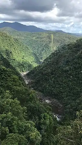 Barron Gorge, 2017 | |||||||||||||||
  Barron Gorge | |||||||||||||||
| Coordinates | 16°52′54″S 145°39′52″E / 16.8816°S 145.6644°E | ||||||||||||||
| Population | 0 (2016 census)[1] | ||||||||||||||
| • Density | 0.00/km2 (0.00/sq mi) | ||||||||||||||
| Postcode(s) | 4870 | ||||||||||||||
| Area | 13.3 km2 (5.1 sq mi) | ||||||||||||||
| Time zone | AEST (UTC+10:00) | ||||||||||||||
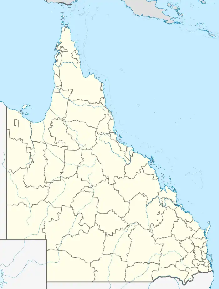
| Location |
| ||||||||||||||
| LGA(s) | Cairns Region | ||||||||||||||
| State electorate(s) | Barron River | ||||||||||||||
| Federal division(s) | Leichhardt | ||||||||||||||
| |||||||||||||||
Barron Gorge is a rural locality in the Cairns Region, Queensland, Australia.[2] In the 2016 census Barron Gorge had a population of 0 people.[1]
Springs is a neighbourhood in the narrow centre part of the locality (16°52′00″S 145°40′00″E / 16.8666°S 145.6666°E).[3]
Geography
Almost the entire area of the locality is undeveloped land within the Barron Gorge National Park which also extends into a number of neighbouring localities. The land rises from approximately 10 metres above sea level to the east of the locality up to a number of named peaks, including:[4]
- Red Peak, 590 metres (1,940 ft) above sea level in the north of the locality (16°51′02″S 145°40′20″E / 16.8505°S 145.6722°E).[5]
- North Peak, 730 metres (2,400 ft) in the middle of the locality (16°53′39″S 145°40′25″E / 16.8941°S 145.6736°E)[6]
- Mount Williams, also known as Tokim Peak, 1,010 metres (3,310 ft) in the south of the locality (16°54′48″S 145°39′48″E / 16.9133°S 145.6633°E)[7]
- Red Bluff, a cliff (16°52′00″S 145°40′00″E / 16.8666°S 145.6666°E)[8]
The name of the locality derives from the gorge created by the Barron River through the Macalister Range and the Lamb Range.[9][10]
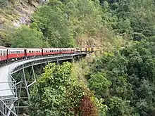
The Cairns-to-Kuranda railway line provides the north-western boundary of the locality and also part of the south-eastern locality. The railway line is used by the Kuranda Scenic Railway tourist service which includes stops at scenic lookouts.[10] There were two railway stations on this line within the locality:
- Springs railway station, now abandoned (16°52′10″S 145°39′54″E / 16.8695°S 145.6650°E).[11]
- Stoney Creek railway station (16°52′48″S 145°39′12″E / 16.8801°S 145.6533°E),[11] situated where the railway line crosses Stoney Creek (16°51′54″S 145°40′04″E / 16.8651°S 145.6677°E), a tributary of the Barron River[12]
There is only one road through the locality, the Barron Gorge Road, which starts in Carvonica and Kamerunga and provides access to the Barron Gorge Hydroelectric Power Station.[10]
History
In the 2016 census Barron Gorge had a population of 0 people.[1]
Attractions
The Skyrail Rainforest Cableway passes through the locality with Red Peak Station (16°50′57″S 145°40′10″E / 16.8493°S 145.6695°E),[13][14] a stopping point within the locality which features guided boardwalk tours through ancient tropical rainforests, featuring a 400-year-old Kauri pine tree. There is no entry to the cableway from the locality; its terminals are in Smithfield and Kuranda.[15]
References
- 1 2 3 Australian Bureau of Statistics (27 June 2017). "Barron Gorge (SSC)". 2016 Census QuickStats. Retrieved 20 October 2018.
- ↑ "Barron Gorge – locality in Cairns Region (entry 48514)". Queensland Place Names. Queensland Government. Retrieved 26 December 2020.
- ↑ "Springs – locality unbounded in Cairns Regional (entry 31996)". Queensland Place Names. Queensland Government. Retrieved 26 December 2020.
- ↑ "Mountain peaks and capes - Queensland". Queensland Open Data. Queensland Government. 12 November 2020. Archived from the original on 25 November 2020. Retrieved 25 November 2020.
- ↑ "Red Peak – peak in Cairns Regional (entry 28180)". Queensland Place Names. Queensland Government. Retrieved 26 December 2020.
- ↑ "North Peak – peak in Cairns Regional (entry 24694)". Queensland Place Names. Queensland Government. Retrieved 26 December 2020.
- ↑ "Mount Williams – peak in Cairns Regional (entry 34731)". Queensland Place Names. Queensland Government. Retrieved 26 December 2020.
- ↑ "Red Bluff – cliff in Cairns Regional (entry 28126)". Queensland Place Names. Queensland Government. Retrieved 26 December 2020.
- ↑ "Barron Gorge National Park". Parks and forests. Queensland Government. 8 September 2006. Archived from the original on 26 March 2021. Retrieved 1 April 2021.
- 1 2 3 "Queensland Globe". State of Queensland. Retrieved 4 March 2018.
- 1 2 "Railway stations and sidings - Queensland". Queensland Open Data. Queensland Government. 2 October 2020. Archived from the original on 5 October 2020. Retrieved 5 October 2020.
- ↑ "Stony Creek – watercourse in Cairns Regional (entry 32552)". Queensland Place Names. Queensland Government. Retrieved 26 December 2020.
- ↑ "Aerial cableway - Queensland". Queensland Open Data. Queensland Government. 18 November 2020. Archived from the original on 24 November 2020. Retrieved 24 November 2020.
- ↑ "Tourist points - Queensland". Queensland Open Data. Queensland Government. 18 November 2020. Archived from the original on 24 November 2020. Retrieved 24 November 2020.
- ↑ "Skyrail Rainforest Cableway". Kuranda Info. Archived from the original on 5 March 2021. Retrieved 1 April 2021.
External links
 Media related to Barron Gorge at Wikimedia Commons