
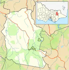
Barwidgee (formerly known as Barwidgee Creek) is a rural locality in northeast Victoria, Australia. The nearest town to Barwidgee is Myrtleford about 5.44 km away. Barwidgee is within Alpine Shire.
Barwidgee Creek Post Office opened on 1 March 1912 and closed in 1957.[2]
Barwidgee was affected by the Black Saturday bushfires, with some deaths in the region and many homes lost.[3]
References
- ↑ Australian Bureau of Statistics (27 June 2017). "Barwidgee(State Suburb)". 2016 Census QuickStats. Retrieved 17 March 2018.
- ↑ Premier Postal History. "Post Office List". Premier Postal Auctions. Retrieved 26 May 2011.
- ↑ "Australia's bushfire disaster: many good people lie dead in Victoria". The Sydney Morning Herald. 9 February 2009.
Localities in the Alpine Shire | ||
|---|---|---|
| Town |
|  |
| Locality |
| |
^ - Territory divided with another LGA | ||
This article is issued from Wikipedia. The text is licensed under Creative Commons - Attribution - Sharealike. Additional terms may apply for the media files.