Königswalde | |
|---|---|
 Coat of arms | |
Location of Königswalde within Erzgebirgskreis district 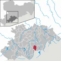 | |
  Königswalde  Königswalde | |
| Coordinates: 50°32′48″N 13°2′50″E / 50.54667°N 13.04722°E | |
| Country | Germany |
| State | Saxony |
| District | Erzgebirgskreis |
| Subdivisions | 2 |
| Government | |
| • Mayor (2020–27) | Ronny Wähner[1] (CDU) |
| Area | |
| • Total | 19.51 km2 (7.53 sq mi) |
| Elevation | 537 m (1,762 ft) |
| Population (2021-12-31)[2] | |
| • Total | 2,177 |
| • Density | 110/km2 (290/sq mi) |
| Time zone | UTC+01:00 (CET) |
| • Summer (DST) | UTC+02:00 (CEST) |
| Postal codes | 09471 |
| Dialling codes | 03733 |
| Vehicle registration | ERZ |
| Website | www |
Königswalde is a municipality in the district of Erzgebirgskreis, in Saxony, Germany.
History
From 1952 to 1990, Königswalde was part of the Bezirk Karl-Marx-Stadt of East Germany.
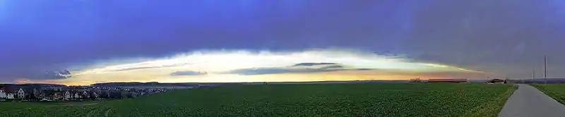
A sunset near Königswalde at Werdau
References
- ↑ Wahlergebnisse 2020, Freistaat Sachsen, accessed 10 July 2021.
- ↑ "Bevölkerung des Freistaates Sachsen nach Gemeinden am 31. Dezember 2021" (XLS) (in German). Statistisches Landesamt des Freistaates Sachsen. 2022.
Sources
- Schumann, August (1818). "Königswalde". Vollständiges Staats-, Post- und Zeitungslexikon von Sachsen (in German). Vol. 5. Zwickau. p. 11.
External links
- Königswalde in the Digital Historic Index of Places in Saxony (Digitales Historisches Ortsverzeichnis von Sachsen)
This article is issued from Wikipedia. The text is licensed under Creative Commons - Attribution - Sharealike. Additional terms may apply for the media files.