Kedar | |
|---|---|
 | |
  Kedar | |
| Coordinates: 31°45′20″N 35°18′34″E / 31.75556°N 35.30944°E | |
| District | Judea and Samaria Area |
| Council | Gush Etzion |
| Region | West Bank |
| Affiliation | Mishkei Herut Beitar |
| Founded | 1984 |
| Founded by | Betar movement |
| Population (2021)[1] | 1,617 |
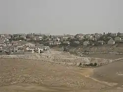
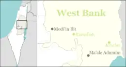
Kedar (Hebrew: קֵדָר) is a rural Israeli settlement in the West Bank. Located to the south of Ma'ale Adumim and organised as a community settlement, it falls under the jurisdiction of Gush Etzion Regional Council. In 2021 it had a population of 1,617.
The international community considers Israeli settlements in the West Bank illegal under international law, but the Israeli government disputes this.[2]
History
According to ARIJ, Israel confiscated 45 dunums of land in 1984 from the Palestinian village of as-Sawahira ash-Sharqiya in order to construct Kedar.[3]
The council was established in 1984[4] by families linked to the Betar movement. The name is taken from Song of Songs (1:5):[5] "Dark am I, o daughters of Jerusalem, dark like the tents of Kedar"
References
- ↑ "Regional Statistics". Israel Central Bureau of Statistics. Retrieved 22 February 2023.
- ↑ "The Geneva Convention". BBC News. 10 December 2009. Retrieved 27 November 2010.
- ↑ As Sawahira ash Sharqiya Town Profile, ARIJ, pp. 18-19
- ↑ "Gush Etzion". Gush Etzion. Archived from the original on 2011-07-21. Retrieved 2011-08-24.
- ↑ "Carta's Official Guide to Israel and Complete Gazetteer to all Sites in the Holy Land. (3rd edition 1993) Jerusalem, Carta, p.383 , ISBN 965-220-186-3