Maasdonk | |
|---|---|
Former municipality | |
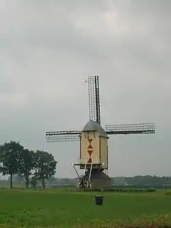 Monumental windmill in Geffen | |
 Flag  Coat of arms | |
.svg.png.webp) Location in North Brabant | |
| Coordinates: 51°44′N 5°28′E / 51.733°N 5.467°E | |
| Country | Netherlands |
| Province | North Brabant |
| Municipality | 's-Hertogenbosch, Oss |
| Established | 1993 |
| Area | |
| • Total | 37.35 km2 (14.42 sq mi) |
| • Land | 37.25 km2 (14.38 sq mi) |
| • Water | 0.10 km2 (0.04 sq mi) |
| Elevation | 6 m (20 ft) |
| Population (January 2021)[3] | |
| • Total | (May 2,014) 11,284 |
| Time zone | UTC+1 (CET) |
| • Summer (DST) | UTC+2 (CEST) |
| Postcode | 5381–5383, 5386, 5390–5392 |
| Area code | 073 |
| Website | www |
Maasdonk (Dutch pronunciation: [ˈmaːzdɔŋk] ⓘ) is a former municipality in the southern Netherlands that existed from 1993 until January 1, 2015,[4] when it was merged into the existing municipalities of 's-Hertogenbosch and Oss.
Population centres
References
- ↑ "Kerncijfers wijken en buurten 2020" [Key figures for neighbourhoods 2020]. StatLine (in Dutch). CBS. 24 July 2020. Retrieved 19 September 2020.
- ↑ "Postcodetool for 5386CL". Actueel Hoogtebestand Nederland (in Dutch). Het Waterschapshuis. Archived from the original on 21 September 2013. Retrieved 30 May 2014.
- ↑ "Bevolkingsontwikkeling; regio per maand" [Population growth; regions per month]. CBS Statline (in Dutch). CBS. 1 January 2021. Retrieved 2 January 2022.
- ↑ "Nieuws uit Maasdonk lees je op BD.nl". www.bd.nl. Archived from the original on 2 January 2015. Retrieved 22 May 2022.
External links
 Media related to Maasdonk at Wikimedia Commons
- Official website
Places adjacent to Maasdonk | ||||||||||||||||
|---|---|---|---|---|---|---|---|---|---|---|---|---|---|---|---|---|
| ||||||||||||||||


This article is issued from Wikipedia. The text is licensed under Creative Commons - Attribution - Sharealike. Additional terms may apply for the media files.