New Haven, Ohio | |
|---|---|
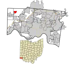 Location in Hamilton County and the state of Ohio | |
| Coordinates: 39°16′32″N 84°44′26″W / 39.27556°N 84.74056°W | |
| Country | United States |
| State | Ohio |
| County | Hamilton |
| Area | |
| • Total | 1.05 sq mi (2.71 km2) |
| • Land | 1.04 sq mi (2.70 km2) |
| • Water | 0.01 sq mi (0.01 km2) |
| Elevation | 561 ft (171 m) |
| Population (2020) | |
| • Total | 572 |
| • Density | 549.47/sq mi (212.14/km2) |
| Time zone | UTC-5 (Eastern (EST)) |
| • Summer (DST) | UTC-4 (EDT) |
| FIPS code | 39-54684[3] |
| GNIS feature ID | 1065119[2] |
New Haven is a census-designated place (CDP) in Crosby Township, Hamilton County, Ohio, United States. The population was 572 at the 2020 census.
History
New Haven was platted as a village by Joab Comstock in 1815. In the 19th century the village had a post office, but was known as "Preston". This was necessary since there was already a New Haven in Huron County, Ohio, and the name was assigned by the first postmaster, Alexander Preston Cavender.
Geography
New Haven is located at 39°16′32″N 84°44′26″W / 39.27556°N 84.74056°W[4] in western Crosby Township, 22 miles (35 km) northwest of downtown Cincinnati and 4 miles (6 km) northeast of Harrison.
According to the United States Census Bureau, the CDP has a total area of 1.3 square miles (3.4 km2), all land.[5]
Demographics
As of the census of 2020, there were 572 people living in the CPD, for a population density of 549.47 people per square mile (212.14/km2). There were 254 housing units. The racial makeup of the CPD was 94.1% White, 0.2% Black or African American, 0.0% Native American, 0.2% Asian, 0.0% Pacific Islander, 0.7% from some other race, and 4.9% from two or more races. 2.3% of the population were Hispanic or Latino of any race.[6]
There were 198 households, out of which 0.0% had children under the age of 18 living with them, 10.6% were married couples living together, 39.4% had a male householder with no spouse present, and 26.3% had a female householder with no spouse present. 56.6% of all households were made up of individuals, and 26.3% were someone living alone who was 65 years of age or older. The average household size was 1.45, and the average family size was 2.05.[6]
0.0% of the CPD's population were under the age of 18, 68.7% were 18 to 64, and 31.3% were 65 years of age or older. The median age was 57.4. For every 100 females, there were 136.1 males.[6]
According to the U.S. Census American Community Survey, for the period 2016-2020 the estimated median annual income for a household in the CPD was $31,750. About 33.3% of the population were living below the poverty line, including 0.0% of those age 65 or over. About 66.7% of the population were employed, and 21.4% had a bachelor's degree or higher.[6]
References
- ↑ "ArcGIS REST Services Directory". United States Census Bureau. Retrieved September 20, 2022.
- 1 2 "US Board on Geographic Names". United States Geological Survey. October 25, 2007. Retrieved January 31, 2008.
- ↑ "U.S. Census website". United States Census Bureau. Retrieved January 31, 2008.
- ↑ "US Gazetteer files: 2010, 2000, and 1990". United States Census Bureau. February 12, 2011. Retrieved April 23, 2011.
- ↑ "Geographic Identifiers: 2010 Demographic Profile Data (G001): New Haven CDP (Hamilton County), Ohio". U.S. Census Bureau, American Factfinder. Archived from the original on February 12, 2020. Retrieved November 14, 2012.
- 1 2 3 4 "New Haven CPD (Hamilton County), Ohio - Census Bureau Profile". United States Census Bureau. Retrieved November 22, 2023.
Municipalities and communities of Hamilton County, Ohio, United States | ||
|---|---|---|
| Cities | 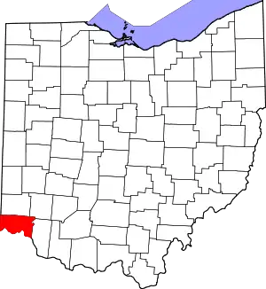 Map of Ohio highlighting Hamilton County | |
| Villages | ||
| Townships | ||
| CDPs |
| |
| Other communities | ||
| Footnotes | ‡This populated place also has portions in an adjacent county or counties | |