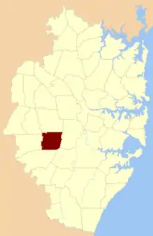
Cabramatta Parish, Cumberland county
The Parish of Cabramatta is a civil parish of Cumberland County,[1] a Cadastral division of New South Wales.[2]
It included the suburbs of Cabramatta, New South Wales, Cecil Hills, Hoxton Park, Rossmore[3][4] and Liverpool.[5] The southern boundary was Bringelly Road, the eastern boundary was Cabramatta Creek, the western Boundary was South Creek and the northern boundary was Orphan School Road in Fairfield.
References
- ↑ John Sands, 1886 map.
- ↑ Parish of Cabramatta, County of Cumberland, New South Wales. Department of Lands 1964.
- ↑ "History of our suburbs: Rossmore". Liverpool City Council. Archived from the original on 18 March 2008. Retrieved 12 April 2008.
- ↑ "Women's history – Liverpool area". Liverpool Women's Resources Centre. Retrieved 6 April 2013.
- ↑ Parish of Cabramatta, County of Cumberland , Department of Lands, Sydney N.S.W, 1940.
This article is issued from Wikipedia. The text is licensed under Creative Commons - Attribution - Sharealike. Additional terms may apply for the media files.