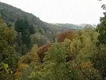
Three miles north of Pitlochry by the A9 road, the Pass of Killiecrankie (Gaelic: Coille Chneagaidh), is a gorge lying between Ben Vrackie (841 m (2,759 ft)) and Tenandry Hill in Perth and Kinross on the River Garry.[1]
The river-gorge traverses the pass over the course of a mile, and above it, the road and the railway, with the village of Killiecrankie at the north end. Much of the area is owned by the National Trust for Scotland.[2]
About a mile toward the village of Killiecrankie, the Battle of Killiecrankie took place in 1689.[3]
There was also a ship, a 3-masted bark named the Pass of Killiecrankie of the Killiecrankie line. The ship was built in 1893 and later renamed Stifinder.[4]
Killiecrankie is part of the Loch Tummel National Scenic Area (NSA),[5] one of 40 such areas in Scotland, which are defined so as to identify areas of exceptional scenery and to ensure its protection by restricting certain forms of development.[6]
Footnotes
- ↑ "Google Maps". Google Maps.
- ↑ "Killiecrankie". Natural Trust for Scotland. Retrieved 17 January 2018.
- ↑ "Killiecrankie, Tenandry and Strathgarry". Tour Scotland. Archived from the original on 16 January 2013. Retrieved 18 December 2007.]
- ↑ Picture of ship.
- ↑ "Map: Loch Tummel National Scenic Area" (PDF). Scottish Natural Heritage. December 2010. Retrieved 2 May 2018.
- ↑ "National Scenic Areas". Scottish Natural Heritage. Retrieved 17 January 2018.
External links
 Media related to Pass of Killiecrankie at Wikimedia Commons
56°44′50″N 3°46′37″W / 56.7471°N 3.7770°W