| Puigpedrós | |
|---|---|
 | |
| Highest point | |
| Elevation | 2,912 m (9,554 ft) |
| Prominence | 644 m (2,113 ft)  |
| Isolation | 16.7 km (10.4 mi) to Carlit |
| Coordinates | 42°29′16″N 1°45′49″E / 42.48778°N 1.76361°E |
| Geography | |
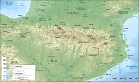  Puigpedrós Location in the Pyrenees | |
| Location | Catalonia, Spain, Pyrénées-Orientales, France |
| Parent range | Pyrenees |
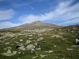
Puigpedrós is a mountain located at the border between Catalonia, Spain and the département of Pyrénées-Orientales (France).
Part of the Pyrenees, its summit has an elevation of 2,912 metres above sea level.[1]
According to the Catalan toponymist Lluís Bassede, the name originates from puig (Catalan word for "mountain with a round peak") and pedrós (meaning, "rocky"), due to the amount of rocks found in its peak.[2]
See also
References
- ↑ "Mapa Topogràfic de Catalunya". Institut Cartogràfic de Catalunya. Retrieved May 22, 2010..
- ↑ Basseda, 1990.
This article is issued from Wikipedia. The text is licensed under Creative Commons - Attribution - Sharealike. Additional terms may apply for the media files.