Saint-Gabriel-de-Valcartier | |
|---|---|
 | |
 Flag  Coat of arms | |
| Motto(s): À l'unisson ("At nature's tempo") | |
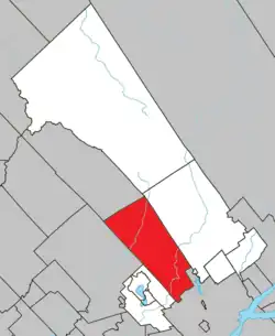 Location within La Jacques-Cartier RCM | |
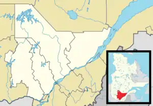  Saint-Gabriel-de-Valcartier Location in central Quebec | |
| Coordinates: 46°56′N 71°28′W / 46.933°N 71.467°W[1] | |
| Country | Canada |
| Province | Quebec |
| Region | Capitale-Nationale |
| RCM | La Jacques-Cartier |
| Settled | 1816 |
| Constituted | October 5, 1985 |
| Government | |
| • Mayor | Brent Montgomery |
| • Federal riding | Portneuf—Jacques-Cartier |
| • Prov. riding | La Peltrie |
| Area | |
| • Total | 446.50 km2 (172.39 sq mi) |
| • Land | 435.22 km2 (168.04 sq mi) |
| Population | |
| • Total | 3,382 |
| • Density | 7.8/km2 (20/sq mi) |
| • Pop 2011-2016 |  15.3% 15.3% |
| • Dwellings | 1,204 |
| Time zone | UTC−5 (EST) |
| • Summer (DST) | UTC−4 (EDT) |
| Postal code(s) | |
| Area code(s) | 418 and 581 |
Highways  A-573 A-573 |  R-369 R-369  R-371 R-371 |
| Website | www |
Saint-Gabriel-de-Valcartier (French pronunciation: [sɛ̃ ɡabʁijɛl də valkaʁtje]) is a municipality in the Capitale-Nationale region of Quebec, Canada, located in the Jacques-Cartier River valley. It has been home to the Canadian Forces Base Valcartier since World War I.
History
In 1647, Robert Giffard de Moncel was granted the Saint-Gabriel seignory that became property of the Jesuits in 1667 and Crown property in 1800. Around 1816, John Neilson (1776-1848), together with Andrew Stuart and Louis Moquin, Quebec lawyers, obtained some 50 concessions in the Saint-Gabriel seignory. This marked the start of the Val-Cartier settlement that was intended to receive Irish and Scottish colonizers.[1]
In 1832, the Parish of Saint-Gabriel-de-Valcartier was formed when it was detached from Sainte-Catherine(-de-la-Jacques-Cartier) and Charlesbourg. In 1845, the Municipality of Valcartier was created in 1845 but abolished in 1847. The Parish Municipality of Saint-Gabriel-de-Valcartier was officially established in 1855, then divided in 1862 into two municipalities: Saint-Gabriel-Ouest and Saint-Gabriel-de-Valcartier.[1]
In 1985, Saint-Gabriel-Ouest and Saint-Gabriel-de-Valcartier were merged again to form the current municipality.[1]
Demography
Population
|
|
|
Private dwellings occupied by usual residents: 1,124 (total dwellings: 1,204)
List of mayors
|
Mayors of Saint-Gabriel-Ouest
|
Mayors of Saint-Gabriel-de-Valcartier
|
Climate
| Climate data for Saint-Gabriel-de-Valcartier, 47°00' N , 71°28' W , estimations 1981−2010, Extremes 1958−Present | |||||||||||||
|---|---|---|---|---|---|---|---|---|---|---|---|---|---|
| Month | Jan | Feb | Mar | Apr | May | Jun | Jul | Aug | Sep | Oct | Nov | Dec | Year |
| Record high °C (°F) | 10 (50) |
12 (54) |
18 (64) |
30 (86) |
33 (91) |
35 (95) |
37 (99) |
35 (95) |
33 (91) |
27.5 (81.5) |
21 (70) |
15 (59) |
37 (99) |
| Mean daily maximum °C (°F) | −8.5 (16.7) |
−5.8 (21.6) |
0.4 (32.7) |
7.9 (46.2) |
16.5 (61.7) |
21.4 (70.5) |
24.2 (75.6) |
22.6 (72.7) |
17 (63) |
9.8 (49.6) |
2.2 (36.0) |
−5.7 (21.7) |
8.5 (47.3) |
| Daily mean °C (°F) | −14.6 (5.7) |
−12.6 (9.3) |
−6.2 (20.8) |
2.1 (35.8) |
9.6 (49.3) |
14.7 (58.5) |
17.5 (63.5) |
16.2 (61.2) |
11 (52) |
4.6 (40.3) |
−2.2 (28.0) |
−10.6 (12.9) |
2.4 (36.3) |
| Mean daily minimum °C (°F) | −20.7 (−5.3) |
−19.4 (−2.9) |
−12.8 (9.0) |
−3.7 (25.3) |
2.7 (36.9) |
7.9 (46.2) |
10.7 (51.3) |
9.7 (49.5) |
5 (41) |
−0.7 (30.7) |
−6.7 (19.9) |
−15.6 (3.9) |
−3.7 (25.3) |
| Record low °C (°F) | −44.5 (−48.1) |
−43 (−45) |
−39 (−38) |
−25 (−13) |
−12 (10) |
−5 (23) |
−1.5 (29.3) |
−3.5 (25.7) |
−10 (14) |
−15 (5) |
−30.5 (−22.9) |
−41 (−42) |
−44.5 (−48.1) |
| Average precipitation mm (inches) | 100 (3.9) |
80 (3.1) |
— | 90 (3.5) |
110 (4.3) |
120 (4.7) |
140 (5.5) |
130 (5.1) |
140 (5.5) |
120 (4.7) |
110 (4.3) |
110 (4.3) |
1,340 (52.8) |
| Average rainfall mm (inches) | — | — | — | — | — | — | — | — | — | — | — | 31.7 (1.25) |
— |
| Average snowfall cm (inches) | 80 (31) |
65 (26) |
50 (20) |
15 (5.9) |
— | 0.0 (0.0) |
0.0 (0.0) |
0.0 (0.0) |
0.0 (0.0) |
5 (2.0) |
42 (17) |
85 (33) |
340 (134) |
| Average precipitation days (≥ 0.2 mm) | 18 | 14 | 14 | 12 | — | 15 | 15 | 15 | 15 | 15 | 16 | 19 | 182 |
| Average relative humidity (%) | 70 | 66 | 63 | 59 | 53 | 59 | 63 | 62 | 64 | 66 | 74 | 76 | 64 |
| Percent possible sunshine | 38 | 43 | 42 | 42 | 44 | 45 | 46 | 47 | 43 | 36 | 30 | 33 | 39.5 |
| Source: Environment Canada[5][6][7][8] | |||||||||||||
See also
References
- 1 2 3 4 "Saint-Gabriel-de-Valcartier (Municipalité)" (in French). Commission de toponymie du Québec. Retrieved 2010-04-19.
- 1 2 Ministère des Affaires municipales, des Régions et de l'Occupation du territoire - Répertoire des municipalités: Saint-Gabriel-de-Valcartier
- 1 2 Statistics Canada 2016 Census - Saint-Gabriel-de-Valcartier census profile
- ↑ Statistics Canada: 1996, 2001, 2006, 2011, 2016 census
- ↑ "Quebec/Jean Lesage INT'L A, Quebec". Canadian Climate Normals 1981−2010. Environment Canada. 31 October 2011. Retrieved 8 May 2014.
- ↑ "QUEBEC/JEAN LESAGE INTL A". Environment Canada. Retrieved July 29, 2015.
- ↑ "Quebec (1875-1959)". Canadian Climate Data. Environment Canada. Archived from the original on 10 April 2016. Retrieved 28 March 2016.
- ↑ "QUEBEC/JEAN LESAGE INTL". Canadian Climate Data. Environment Canada. Archived from the original on 10 April 2016. Retrieved 28 March 2016.
External links
 Media related to Saint-Gabriel-de-Valcartier at Wikimedia Commons
Adjacent Municipal Subdivisions | ||||||||||||||||
|---|---|---|---|---|---|---|---|---|---|---|---|---|---|---|---|---|
| ||||||||||||||||


| Cities & towns | |
|---|---|
| Municipalities | |
| United Townships | |
| Unorganized territories | |
| |