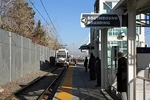
 Southmoor station platform | ||||||||||||||||
| General information | ||||||||||||||||
| Location | 3737 South Monaco Parkway Denver, Colorado | |||||||||||||||
| Coordinates | 39°38′56″N 104°54′59″W / 39.6488°N 104.9163°W | |||||||||||||||
| Owned by | Regional Transportation District | |||||||||||||||
| Line(s) | Southeast Corridor[1] | |||||||||||||||
| Platforms | 1 island platform | |||||||||||||||
| Tracks | 2 | |||||||||||||||
| Connections |  RTD Bus: 35, 40, 46, 65, 105 RTD Bus: 35, 40, 46, 65, 105 | |||||||||||||||
| Construction | ||||||||||||||||
| Structure type | At-grade | |||||||||||||||
| Parking | 788 spaces[2] | |||||||||||||||
| Bicycle facilities | 16 racks, 22 lockers | |||||||||||||||
| Accessible | Yes | |||||||||||||||
| Other information | ||||||||||||||||
| Fare zone | B[3] | |||||||||||||||
| History | ||||||||||||||||
| Opened | November 17, 2006 | |||||||||||||||
| Services | ||||||||||||||||
| ||||||||||||||||
| ||||||||||||||||
Southmoor station is an light rail station in Denver, Colorado, United States. It is served by the E and H Lines, operated by the Regional Transportation District (RTD), and was opened on November 17, 2006.[4][5] It is the southernmost station before the Interstate 225 branch splits from the Southeast Corridor and serves as a transfer station for each line.[6]
The station features an interactive piece of public art entitled Harmonic Pass: Denver.[7] Created by Christopher Janney, it features a mixture of light and sound throughout the pedestrian tunnel. Within each column are photoelectric sensors and an audio speaker. Also, a riddle is etched on plaques on both ends of the tunnel. If a person can decipher the riddle and trigger the columns in the pattern described, the tunnel will “dance” a pattern of light and sound in reply.[7]
References
- ↑ "Southeast Corridor Light Rail Line". RTD – Denver. March 2018. Retrieved February 27, 2022.
- ↑ "Alphabetical park-n-Ride List". Regional Transportation District. Retrieved September 26, 2010.
- ↑ "Rail & Flatiron Flyer Map" (PDF). Regional Transportation District. 2019. Retrieved May 3, 2020.
- ↑ Leib, Jeffrey (November 21, 2006). "A rail easy commute SE line's regular service debuts smoothly". The Denver Post. p. A1.
- ↑ "RTD: Southeast Corridor" (PDF). Regional Transportation District. Archived from the original (PDF) on September 28, 2011. Retrieved September 26, 2010.
- ↑ "Light rail system map". Regional Transportation District. Retrieved September 26, 2010.
- 1 2 "art-n-Transit: A rider's guide to public art on RTD's transit system, Southeast Corridor". Regional Transportation District. Retrieved September 27, 2010.
| Operators |
|  | |||||||||
|---|---|---|---|---|---|---|---|---|---|---|---|
| Rail services |
| ||||||||||
| Bus services | |||||||||||
| Other topics | |||||||||||