Vincent, Ohio | |
|---|---|
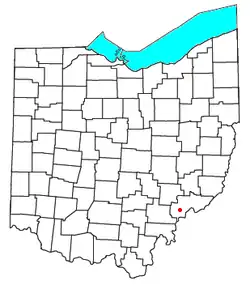 Location of Vincent, Ohio | |
| Coordinates: 39°22′31″N 81°40′16″W / 39.37528°N 81.67111°W | |
| Country | United States |
| State | Ohio |
| County | Washington |
| Township | Barlow |
| Population | |
| • Total | 329 |
| Time zone | UTC-5 (Eastern (EST)) |
| • Summer (DST) | UTC-4 (EDT) |
| ZIP code | 45784 |
Vincent is a census-designated place in southern Barlow Township, Washington County, Ohio, United States. It has a post office with the ZIP code 45784.[2] It lies along State Route 339 near Tupper Creek, a subsidiary of the Little Hocking River, which in turn meets the Ohio River at Little Hocking to the south.[3] The population was 329 at the 2020 census.
History
Vincent had its start when the Marietta & Cincinnati Railroad was extended to that point.[4] The community was founded as Vincents Station in 1853 by Henry Earle Vincent, and named for him.[5] A post office called Vincent has been in operation since 1857.[6]
Education
- Warren High School and Warren Middle School serve local students.
References
- ↑ "Vincent CPD, Ohio - Census Bureau Profile". United States Census Bureau. Retrieved September 10, 2023.
- ↑ Zip Code Lookup
- ↑ DeLorme. Ohio Atlas & Gazetteer. 7th ed. Yarmouth: DeLorme, 2004, p. 81. ISBN 0-89933-281-1.
- ↑ "How communities got their names". Marietta Times. February 19, 2013. Retrieved December 29, 2015.
- ↑ History of Washington County, Ohio: With Illustrations and Biographical Sketches. H.Z. Williams. 1881. p. 719.
- ↑ "Washington County". Jim Forte Postal History. Retrieved December 29, 2015.
Municipalities and communities of Washington County, Ohio, United States | ||
|---|---|---|
| Cities | 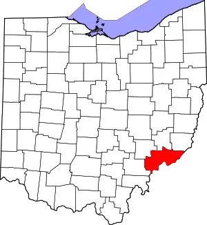 Map of Ohio highlighting Washington County | |
| Villages | ||
| Townships | ||
| CDPs | ||
| Unincorporated communities |
| |
This article is issued from Wikipedia. The text is licensed under Creative Commons - Attribution - Sharealike. Additional terms may apply for the media files.