Wendling, Oregon | |
|---|---|
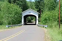 Wendling Bridge, a covered bridge over Mill Creek | |
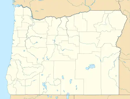  Wendling  Wendling | |
| Coordinates: 44°11′36″N 122°47′51″W / 44.19333°N 122.79750°W | |
| Country | United States |
| State | Oregon |
| County | Lane |
| Elevation | 646 ft (197 m) |
| Time zone | UTC-8 (Pacific (PST)) |
| • Summer (DST) | UTC-7 (PDT) |
| ZIP code | 97454 |
| Area code(s) | 458 and 541 |
| GNIS feature ID | 1136886 |
Wendling is an unincorporated community in Lane County, Oregon, United States, located northeast of Marcola.[1] Wendling's post office operated from 1899 to 1952.[2] It was named for George X. Wendling, a local lumberman.[3][4] Wendling was created as a company town for the Booth-Kelly Lumber Company.
History
A rail line from Coburg, passing through Springfield and Natron, was later extended over Willamette Pass. A branch from Springfield to Wendling was constructed in 1902.[5]
Fires
The main street of the town is but a blackened mass of ruins, not a single post of scantling remaining to mark the spot where the large cookhouse, 80 room hotel and bunkhouse, barber shop, meat market, pool and billiard hall once stood.
— Eugene’s Morning Register, August 26, 1910[6]
In August 1910, Wendling burned down.[7] It also later burned down again on September 29, 1946.[7]
Wendling Bridge, a covered bridge, carries Wendling Road over Mill Creek at Wendling.[8] Built in 1938, the bridge was added to the National Register of Historic Places in 1979.[9]
See also
- Hayden Bridge (Springfield, Oregon) – bridge that was part of the Marcola line, which would take lumber to and from Wendling[10]
References
- ↑ "Wendling". Geographic Names Information System. United States Geological Survey, United States Department of the Interior. November 28, 1980. Retrieved August 17, 2011.
- ↑ "Lane County". Jim Forte Postal History. Retrieved April 23, 2015.
- ↑ McArthur, Lewis A.; McArthur, Lewis L. (2003) [1928]. Oregon Geographic Names (7th ed.). Portland, Oregon: Oregon Historical Society Press. pp. 1020–1021. ISBN 978-0875952772.
- ↑ "Names of Lane County Communities Reveal Interesting Histories, Anecdotes". Eugene Register-Guard. January 4, 1942. p. 4. Retrieved April 23, 2015.
- ↑ Leslie M. Scott: History of the narrow gauge railroad in the Willamette Valley. June 1919, Oregon Historical Quarterly.
- ↑ Eugene’s Morning Register, August 26, 1910 in "Lost Towns: Wendling". Lane County History Museum. 2016.
- 1 2 "Lost Towns: Wendling". Lane County History Museum. 2016.
- ↑ "Mill Creek (Wendling) Covered Bridge" (PDF). Oregon Department of Transportation. Retrieved March 16, 2016.
- ↑ "Oregon National Register List" (PDF). Oregon Parks and Recreation Department. June 6, 2011. p. 23. Retrieved July 17, 2011.
- ↑ Link, Gary (1992). Bennett, Lola (ed.). Hayden Bridge (PDF) (Report). Washington, DC: Historic American Engineering Record. Survey number: OR-19.
Further reading
- Polley, Louis E. (1984). A history of the Mohawk Valley and early lumbering. Marcola, Oregon: Polley Pub. ISBN 0916930092.
- Velasco, Dorothy (1985). Lane County: An Illustrated History of the Emerald Empire. Windsor Pubns. ISBN 0897811402.
- Polley, Louis E. (1989). Wendling, Oregon Logging Camps 1898-1945: Polley Pub. ASIN B006YXHNG6
- KRACHT, SHANNON. "Wendling, a Company Town," Lane County Historian 20 (1975): 3-16.
External links
- "Booth-Kelly Company Ghost Town – Wendling Oregon".
- "The Wendling Project".
- Warner, George. "Growing up in Wendling Oregon".
- Lost Towns: Wendling by the Lane County History Museum
Municipalities and communities of Lane County, Oregon, United States | ||
|---|---|---|
| Cities | 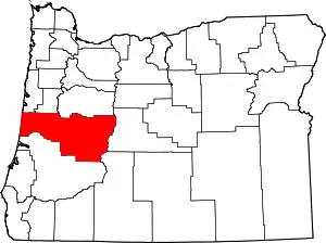 Lane County map | |
| CDPs | ||
| Other communities |
| |
| Ghost towns | ||
| Indian reservation | ||
| Footnotes | ‡This populated place also has portions in an adjacent county or counties | |