| Wingeel Victoria | |||||||||||||||
|---|---|---|---|---|---|---|---|---|---|---|---|---|---|---|---|
  Wingeel | |||||||||||||||
| Coordinates | 38°05′00″S 143°51′00″E / 38.08333°S 143.85000°E | ||||||||||||||
| Population | 26 (2021 census)[1] | ||||||||||||||
| Postcode(s) | 3321 | ||||||||||||||
| Location | |||||||||||||||
| LGA(s) | |||||||||||||||
| State electorate(s) | Polwarth | ||||||||||||||
| Federal division(s) | |||||||||||||||
| |||||||||||||||
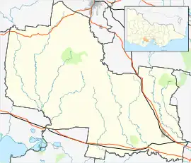
Wingeel is a rural locality in Victoria, Australia. The locality straddles both the Colac Otway Shire and the Golden Plains Shire, the former containing the largest portion.[2] In the 2021 census, Wingeel had a population of 26.[1]
References
- 1 2 Australian Bureau of Statistics (28 June 2022). "Wingeel (State Suburb)". 2021 Census QuickStats. Retrieved 27 November 2023.
- ↑ "Wingeel (entry 103342)". VICNAMES. Government of Victoria. Retrieved 27 November 2023.
This article is issued from Wikipedia. The text is licensed under Creative Commons - Attribution - Sharealike. Additional terms may apply for the media files.